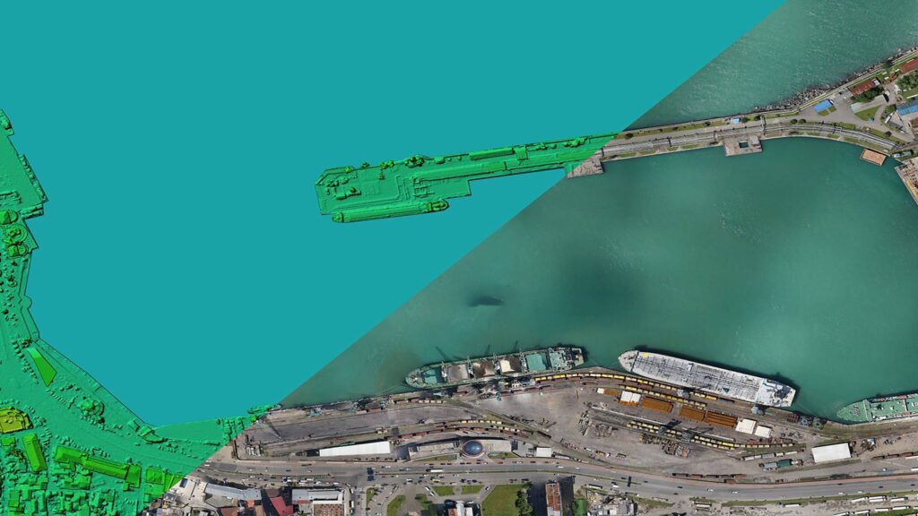
Description
RAF Veteran owned and operated, ARC Aerial Imaging provides a complete service in high resolution UAV aerial imaging acquisitions with various sensing forms, in-house geospatial processing, imagery analysis, consulting and training services in UAV aerial imaging in mapping, surveying and photogrammetry applications for UAV operators and operating organisations.
Primarily based within the North East of England but having national reach, its services are not just generic but specialised for many technical commercial imaging undertakings thus providing ‘intelligence from imaging’ from informed and comprehensive perspectives.
With a UK CAA 'Operational Authorisation' firmly in place since January 2015, ARC Aerial Imaging utilises sUAS to not only provide generic aerial stills and UHD video for a variety of commercial uses and services but also provides specialist aerial imaging consulting through their processed technical datasets which is based on its Imagery and Spatial Analyst's 30 years of formal knowledge and experience.
In a training capacity, ARC Aerial Imaging currently provides market-leading sUAS business development masterclass courses in Drone Aerial Imaging for Mapping, Surveying and a Photogrammetry. These professional and nationally-leading ‘Phase 2’ UAV training courses cover from the fundamentals and principles of aerial imaging to enhance commercial drone operators’ knowledge in mapping with drones by understanding how to accurately plan and collate this imaging form from various drone platforms and digital sensing right up to how to produce and present to clients enhanced drone-acquired geospatial products with photogrammetry and GIS applications.

Add a review